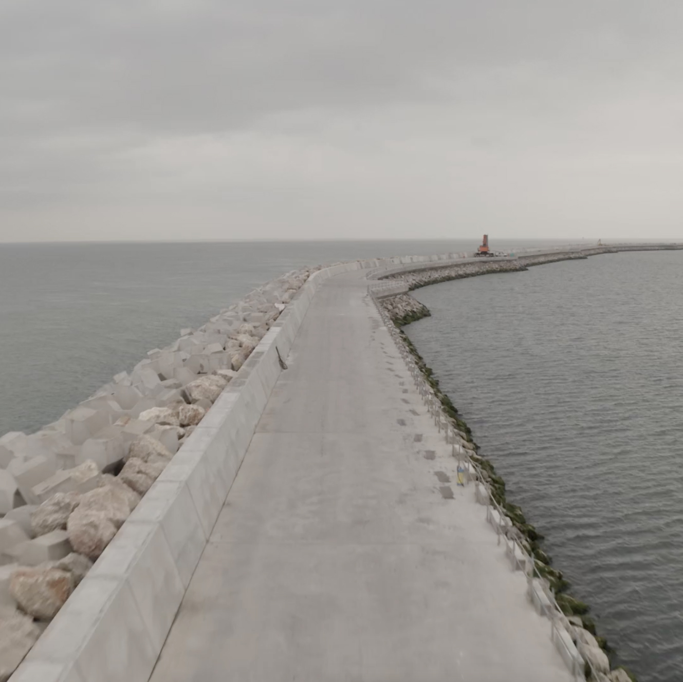
The breakwater is the construction site project main threat which lasted nearly six years. The purpose of the breakwater is to protect navigation in the basin and the facilities of the new port.
It is more than 3.2 km long (3,260 meters) and almost 90 meter wide at its underwater base with an optimized profile to significantly reduce the impact on the stream and the morphology of the seabed and the coastline.
The breakwater was made up of four successive layers of materials and riprap i.e. more than 6 million tons from local quarries as a priority. Its shell is made up of more than 16,500 X-blocs® and was designed to withstand storms and rising water levels for the next hundred years. There is at the top of the breakwater an imposing concrete slab with a sea wall allowing machinery and service personnel operating safely.
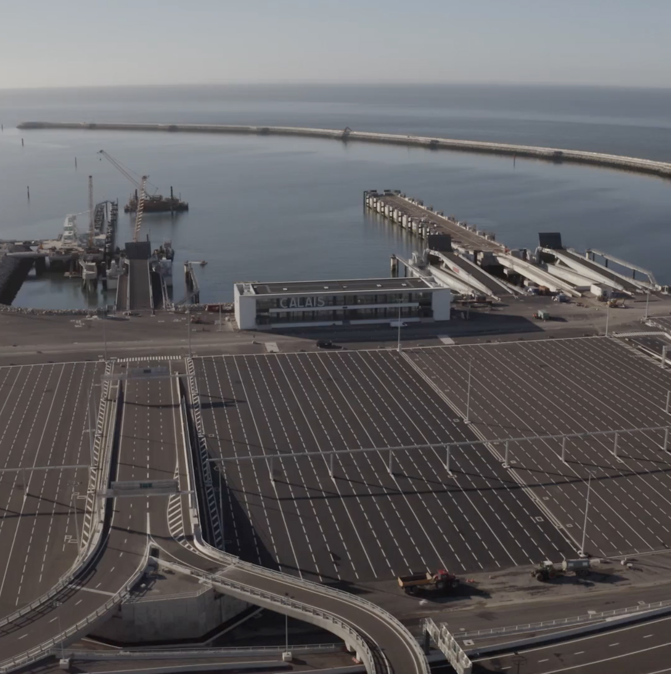
The new port breakwater surrounds a 200-hectare water basin of which 90 hectares are navigable in phase 1 (150 hectares in the long term).
The new basin was created by dredging 4 million m3 of sand (recovered to set up the new port platform!).
Its maximum depth is more than 21 meters at high tide and allows the entry and berthing of new generation ships of 240 meters in length. Thanks to several turning areas, it also allows several ferries manoeuvring at the same time.
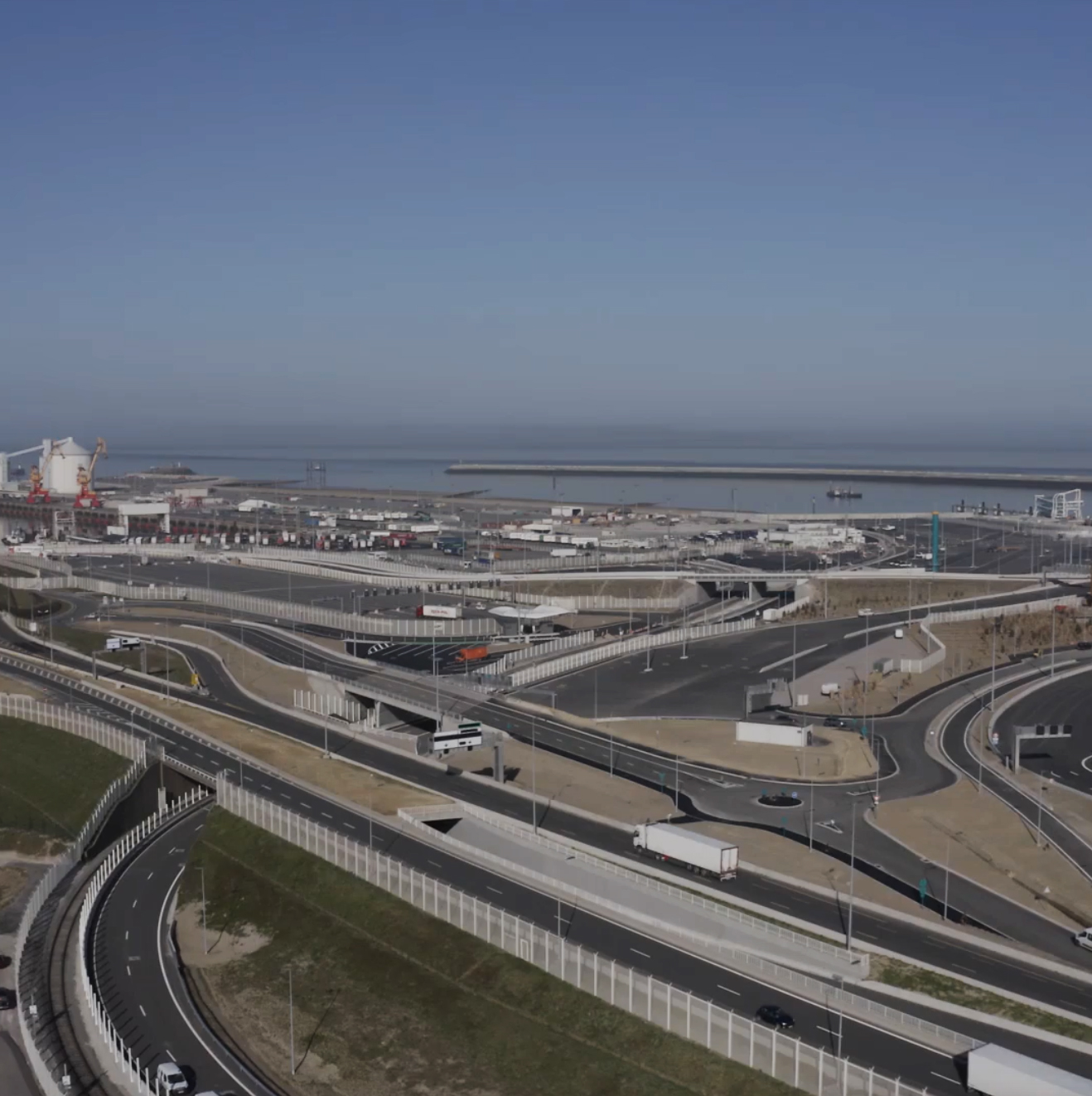
65 hectares of new land of which 45 were reclaimed from the sea. The new platform started to be created in 2016 and required 4 million cubic meters of sand, all of it dredged from the basin resulting in backfilling more than 15 meters high.
There are 350 kilometers of electrical wiring, 15 kilometers of sewage networks, 8 bridges, roads, car parks, lighting and 31 buildings… set up on this huge platform.
Dedicated terminals for unaccompanied trailers and rail freight activities were also provided in this developed area.
At last the project also takes into account future long-term operational possibilities. The general layout allows extension of the platforms and installation of new berths in later phases of development.
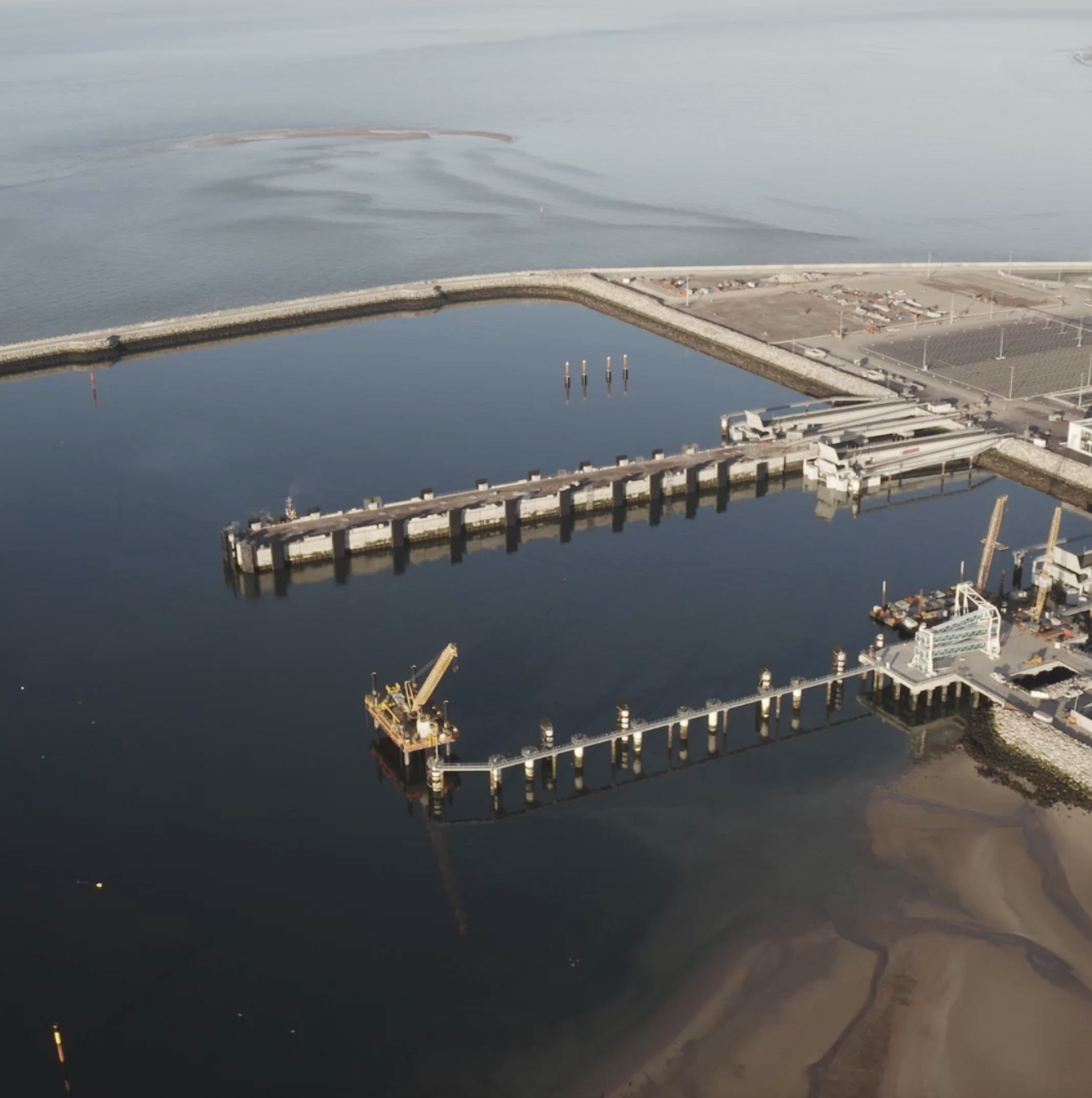
3 high capacity ferry berths were built for this first phase of the new port. They will be able to accommodate vessels of 240 meters in length, 36 meters in width and 8.50 meters draught 24 hours a day, 7 days a week. By adapting the length of the berths and the capacity of the fenders in the long term, even larger vessels can be accommodated.
Each berth was specially designed: P10 has 68 support foundation piles. These piles were topped with 306 prefabricated concrete elements made on the construction site on which a concrete slab was poured.
P11 and P12 berths are located on either side of a 300 meter long and 26 meter wide “finger pier”: it is made up of mixed sheet piling and H-iron caissons filled with sand on which a large concrete cap beam is anchored covering the entire upper part of the curtain. This double wharf allows two ships to berth at the same time.
The three new berths are all equipped with a floating link-span for vehicle transfers to and from the ferry. Weighing more than 2,000 tons, 100 m long and 32 m wide, they are ballastable to adapt to each level of freeboard of the ships, and a system of jacks allows the ramps to be finely adjusted during loading.
In addition, the P10 pier has a passenger gangway over 20 meters high to cope with summer pedestrian flows.
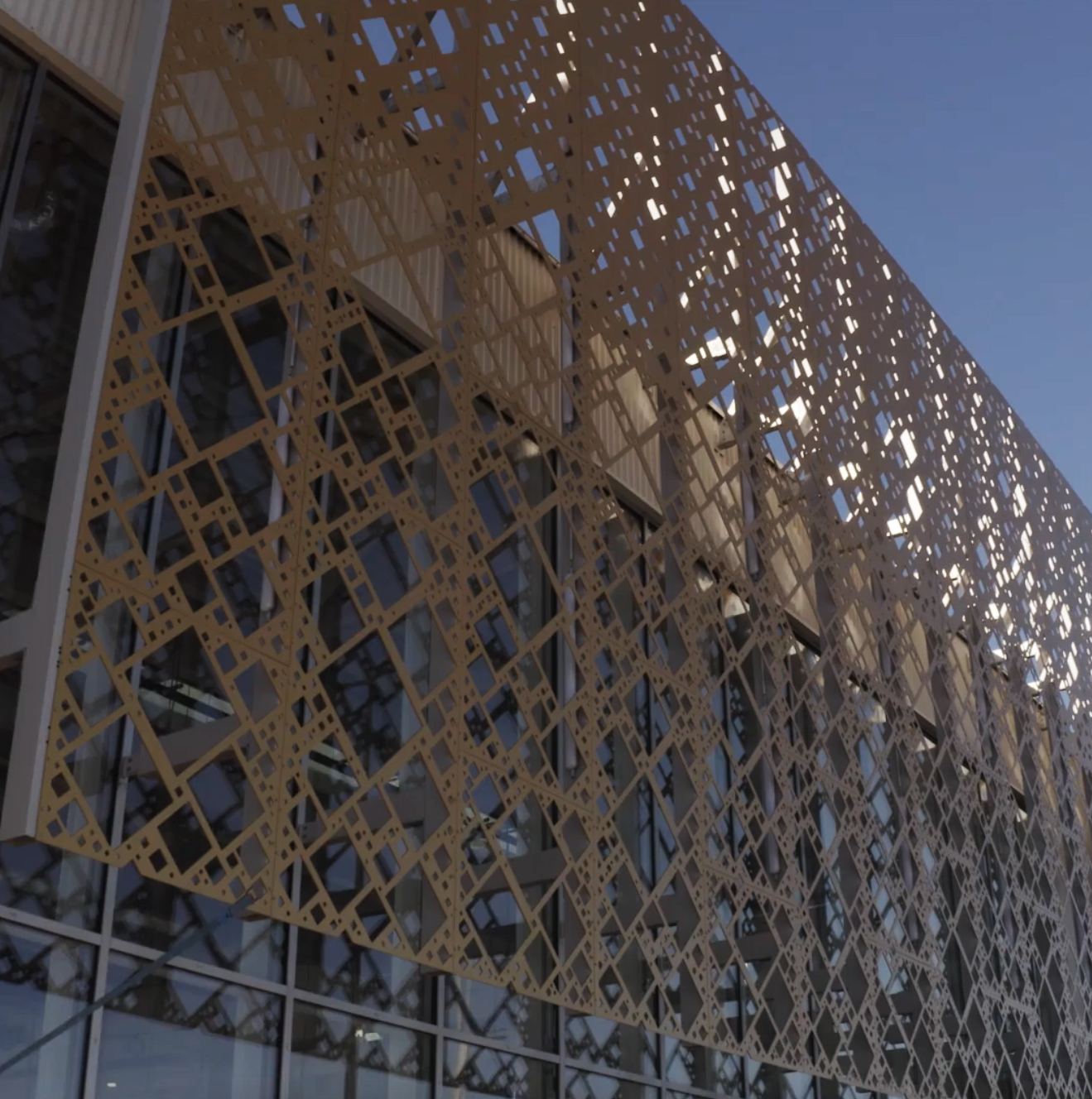
MORE THAN 10,000 SQUARE METERS OF BUILDINGS surface à verifier
About ten different buildings were built on the new port, each has a specific function:
There are now more than 80 ticket offices and counters along the travellers’ journey and some fifteen toilet blocks in the service buildings and pre-boarding car parks are available…
This is particularly the Port Entrance Building and the Sea Front Building that become the emblematic places of the new port thanks to their accessibility and the services to be offered there. Both commensurate with the new port by their size and their architecture and offer a different but unobstructed view of the platform, the basin and the berths.
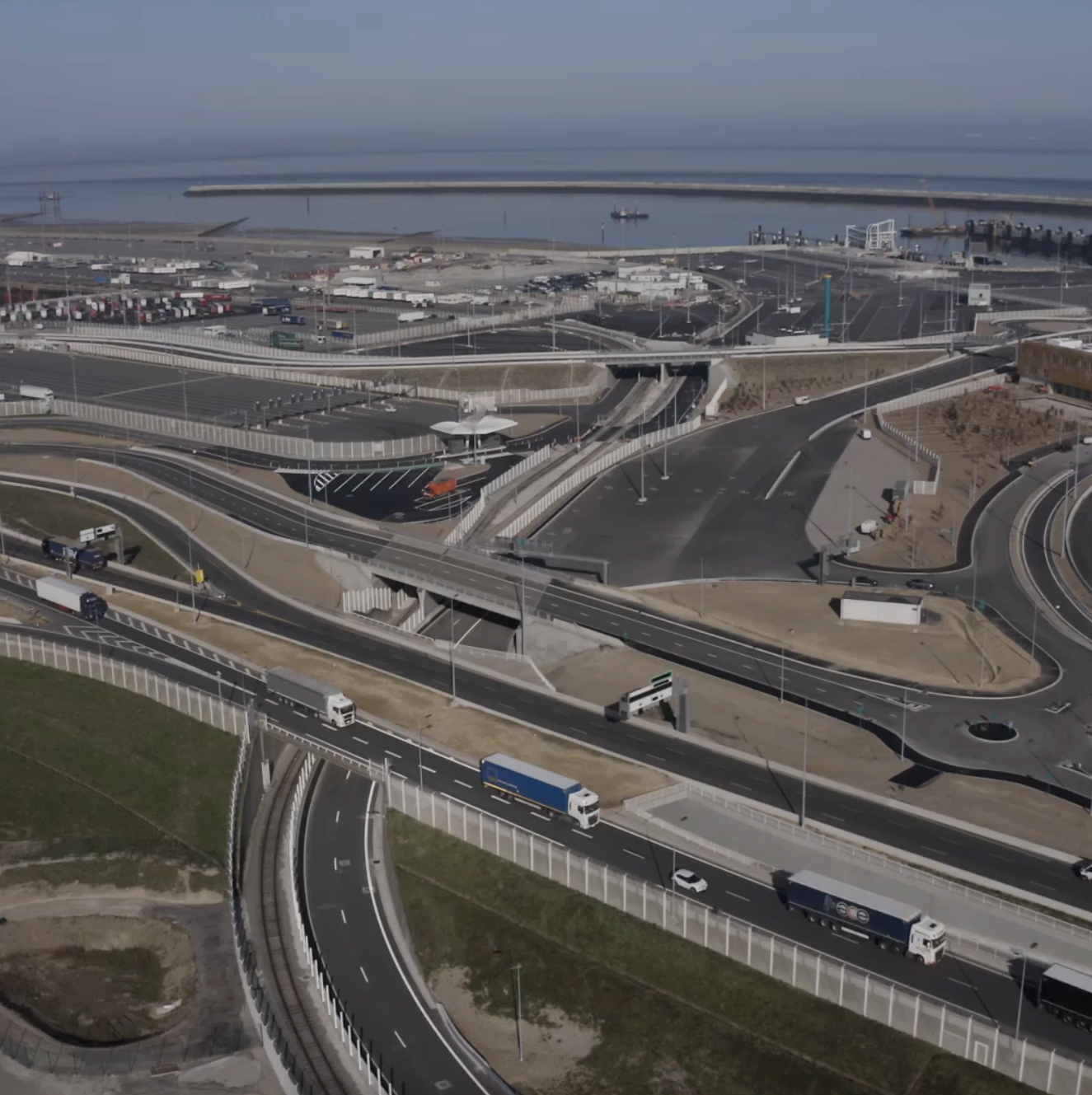
The new Port of Calais entrance and exit have now up to 4 lanes each. This significant increase in the port ring road capacity will improve the flow of access to the various terminals in the port as well as to the city of Calais.
Cross-Channel passengers travelling by car or coach will use dedicated lanes from disembarking the boat to the ring road. Once crossing the cut-and-cover tunnel, insertion will be from the left without the risk of telescoping with the flows of heavy goods vehicles inserting from the right.
A new LED lighting system was designed to take into account the port ring road widening in continuity with the improvements made by the DIR Nord in charge of maintaining, operating and developing the road network, the RN 216 linking the port ring road to the A16 motorway.
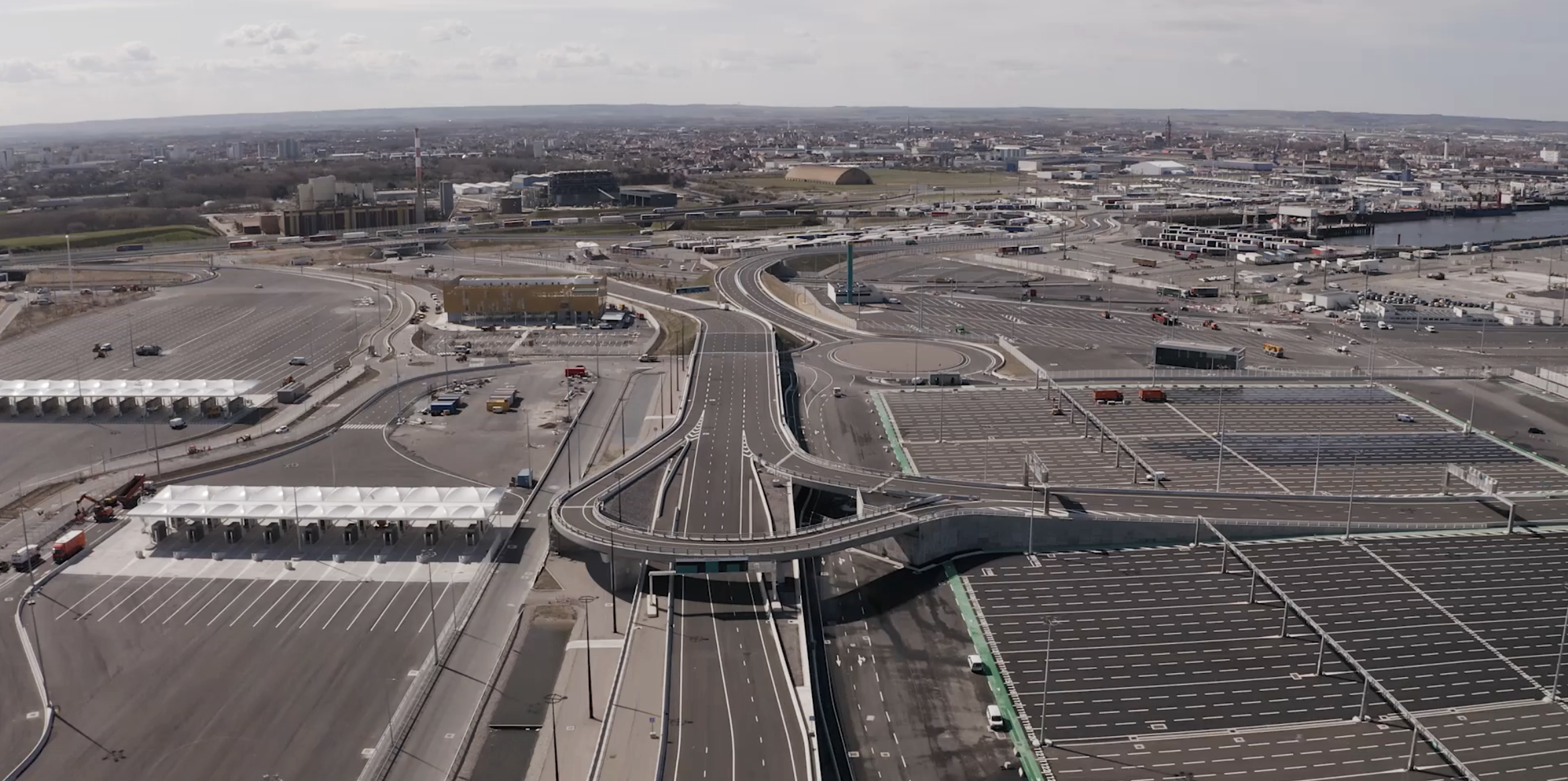
There are 7 bridges and 1 cut-and-cover tunnel on the new platform, some of them create the ‘backbone’ structure of the new port: the road central ridge connecting the Southern and Northern aeras allowing quick disembarkation of passengers and goods.
The design of the roads, ramps, etc., the control areas layout and the pre-boarding car parks size were based on numerous studies and dynamic modelling.
The separated freight and tourist flows, the number and width of lanes, the layout and shape of the bridges were designed to anticipate the traffic changes over the next few decades with the constant concern to ensure a fluid and safe traffic for the new port customers.